
Home/Sectors/Towage & pilotage
Independent AIS data for towage operators and pilotage services
Ship assist resolves inside the breakwater in seconds, below the resolution of most feeds. We supply raw positions from our own network, scoped to the harbours you work, so jobs can be reconstructed, tenders priced and claims evidenced.
100,000+
Vessels tracked / day
49M+
AIS positions / day
40+
Countries covered
<5s
Antenna to your API
Tug tracking data that resolves what happens between made fast and let go
Towage is conducted inside the breakwater in events lasting seconds. Positions reported every few minutes cannot resolve them.
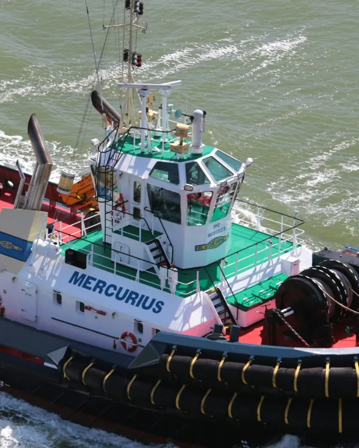
The manoeuvre resolves in seconds.The work is performed inside the breakwater, up a river, on the bend below a jetty, and turns on the tug coming on, the line made fast, the push or the pull, the let go. Reconstruction of a ship assist requires dense terrestrial receivers across the port approaches and a refresh interval measured in seconds.
Recollection is not evidence.Made fast and let go times originate in the master’s log or a deckhand’s recollection, so a tariff dispute, a delay claim or a terminal service dispute reduces to one party’s account against another’s. A continuous position record establishes the assisted vessel’s speed over ground through the manoeuvre.
Tenders are priced on assumption.Operators bid for harbour, terminal, escort and LNG towage work with no sight of the incumbent’s job count, tugs per call or share of the port, and concede either margin or the award. Fleet sizing rests on the same assumptions. Each of those figures is recoverable from the position record.
Speed of the assisted vessel when the harbour tug Biter girted and capsized off Greenock on 24 February 2023 with the loss of two lives, against a recommended 2 to 3 knots, putting between two and five times the expected load on the tug’s towlines.
MAIB report 17/2024Coverage in your port, confirmed before you commitSpecify the harbour and the approach channel, and we will confirm what our own network covers there.
Check coverage in your portWhat operators do with AIS data for tug movements in a port
Reconstruct ship-assist jobs from the position record
A dense position record resolves each stage of a job: mob, approach, made fast, push or pull, let go, standby, demob. Position derived timestamps give billing and job logging a reference independent of the deck log.
Price a towage tender on traffic, not assumption
Before tendering for harbour, terminal or escort towage, establish the call count, the tugs per call and the vessel classes served in that port, then derive towage market share by port from the tracks. The same analysis informs renewals and entry into new harbours.
Evidence a safety case or a liability claim
Position data evidences a navigational risk assessment, a Ports and Marine Facilities Safety Code review (formerly the Port Marine Safety Code) or a casualty investigation: assisted vessel speed over ground on the towline, tug position and timing through the manoeuvre, and the units attributed to the job.
Review escort policy and critical transits
Establish which vessels transit a bridge, a lock or another critical structure under tethered escort and which do not, from the position record rather than recollection. The same record supports traffic density and encounter analysis for the harbour authority.
Report tug utilisation, fuel and CO2 per job
Apportion a tug’s year across jobs, standby and transit, then attribute fuel burn and emissions to each job for terminal customers, port emissions inventories and green tariff negotiations. The figures derive from positions, so reporting does not rest on manual returns.
Drive pilot dispatch and boarding ground planning
Feed inbound ETA at the pilot boarding ground into rostering and launch scheduling, and supply the pilot association with transfer counts and launch utilisation for establishment and fee negotiations. Delivered as an AIS API or a stream into your own dispatch software.
Where the positions come from
We own the infrastructure that collects the data, so coverage is stated port by port.
Monitor
Cover the approaches and the berths
Our own network tracks 100,000+ vessels and 49M+ AIS positions a day across 40+ countries, with terrestrial coverage aimed at port approaches and inner harbours rather than open ocean vessel counts.
Verify
Know the position is real
Every station runs the same dedicated standardised hardware and encrypts each message the instant it is captured. Every position is nanosecond time-stamped and given a trust score by anomaly detection models.
Act
Run it inside your own tooling
Take it as raw NMEA over TCP, a REST API or a WebSocket stream, scoped to the geofence you asked for, and put it behind your dispatch, job logging, billing or utilisation product rather than buying another front end.
AIS data for towage operators: common questions
Does AIS cover tugs inside the harbour?
Coverage depends on where the receivers are sited. Satellite AIS resolves poorly inside a breakwater or up a river, because the refresh interval is too long to separate made fast from let go. Terrestrial receivers across the approaches provide the density and the seconds level refresh that job detection requires. We state coverage harbour by harbour, so it can be verified against the ports you work rather than accepted as a global claim.
What AIS ship type code is a tug?
Type 52 is tug, 31 and 32 are towing, and 50 is a pilot vessel. In practice tugs are miscoded across all three towing and tug values, navigational status 11 and 12 for towing astern and pushing ahead is rarely set correctly, and MMSIs are reassigned when a vessel changes fleet. Job detection built on the ship type field alone fails against those records, which is why we supply the raw messages and the trust score in place of a corrected label.
How often does a tug update its AIS position?
A Class A transponder reports every few seconds while the vessel is manoeuvring, around ten seconds at low speed, and only every few minutes when moored. Class B units, common on workboats and pilot launches, report far less frequently. Delivery matters as much as the transponder. Our own network delivers under 5 seconds from antenna to your API, so a rapid manoeuvre is not averaged away in transit.
Can I license AIS data inside my own dispatch software?
Yes. Embedding positions and derived analytics inside your own dispatch, job logging, billing or utilisation product is a licensed use, and the scope is written into the licence rather than left ambiguous. We are an independent supplier operating our own network, which matters in a market where several upstream feeds now sit under common ownership. Describe what you are building and we will scope the licence to it.
Do you cover the harbours we work, and how do we check?
Coverage varies by location, and we supply only what our own network collects. Rather than quote a single global figure, we take the geofence in question and state what the network sees there before you commit. That is the fastest way to establish whether we are useful in the harbours you actually work.
Related sectors


Start with the harbour you actually work in
Name the port and the geofence, and we will confirm what our own network covers there.
Check coverage in your port