The Ultimate Guide to AIS Boat Tracking Explained
- Team WAKE

- Jun 2, 2025
- 5 min read

Getting Behind AIS Boat Tracking
Automatic Identification System (AIS) is an innovative tool that has positively impacted various maritime activities, enhancing the security and effectiveness of vessel operations. Initially created to prevent accidents at sea, this tracking system is traditionally utilized by shipping firms, coast guards, and vessel traffic services to monitor and track maritime vessels in real-time.
Since AIS broadcasts vital information like a vessel's identity, position, speed, and navigation status, it has become a critical instrument to elevate the ship navigation domain. This technology has not just improved the safety of maritime operations, but it has also evolved to support a variety of purposes such as fleet management, environmental monitoring, and even search and rescue undertakings.
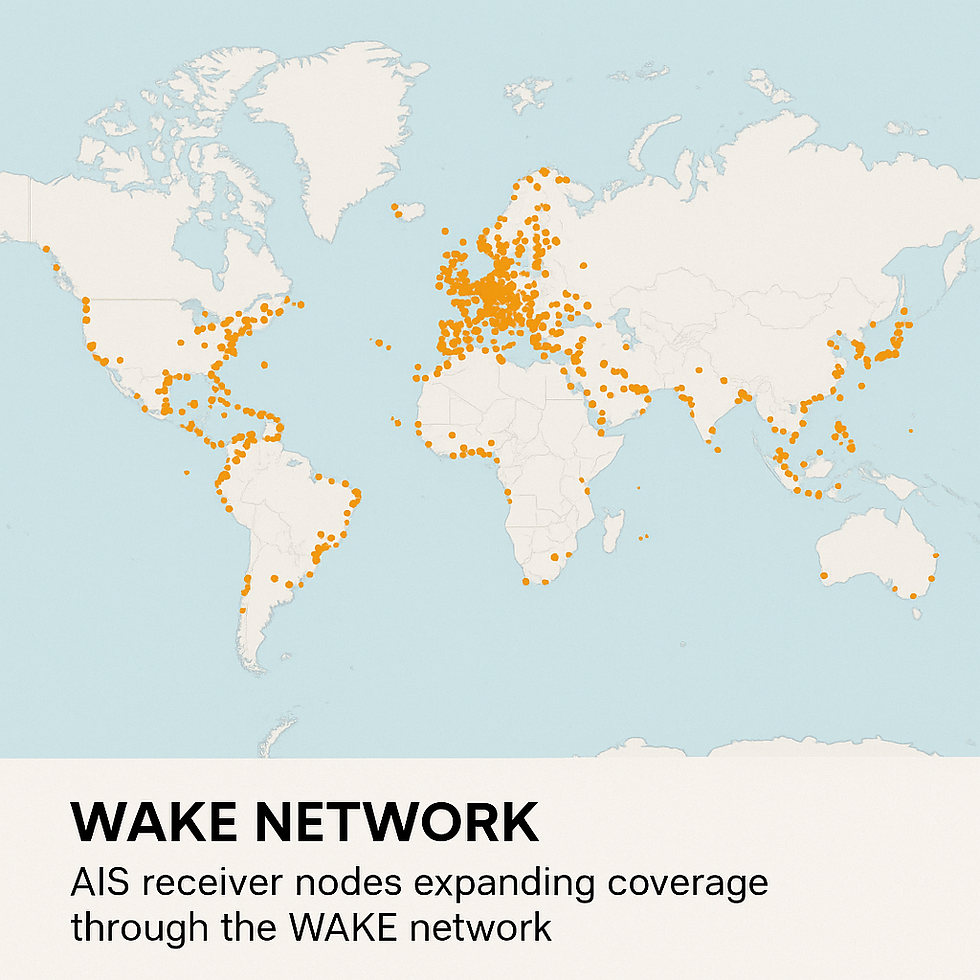
Embracing this technology has resulted in an increased ability to monitor vessels over vast areas, as more ships are now equipped with AIS transponders. The fusion of AIS with vessel traffic services has been instrumental in aid for harbour authorities to have a clear overview of maritime traffic, ensuring that crowded waterways remain as secure as possible.
In the realm of contemporary ship navigation strategies, the reliability and flexibility of AIS boat tracking is undeniable.
What makes AIS technology tick?
At the heart of AIS technology lie transponders mounted on vessels. These trackers emit their current status at regular intervals, broadcasting a continuous data stream that includes a vessel's unique identification number, its current location coordinates derived from GPS, speed, heading, and other navigational information. This information is then picked up by nearby ships, satellites, and observatory stations along coastlines to create a dynamic, live map of where each vessel is.
One compelling advantage of AIS is its vast operating range, establishing it as a critical tool for marine vessel tracking. Its signals are usually transmitted at VHF frequencies and are able to cover vast quantities of water, assuming minimal interference exists. Various receivers, onboard vessels and stationary along coastal facilities, pick these signals to compile a holistic image of maritime traffic.
Moreover, blending AIS boat tracking with other ship navigation technologies improves its effectiveness. With this integration, the translation of advanced algorithms and real-time data analytics enables users to predict vessel movements, assess potential risks and make informed decisions about routing and safety measures.
Internationally, AIS data is shared across borders using standardized communication systems, ensuring that vessels operating under different jurisdictions can flawlessly interact with one another. Not just in routine navigation, but AIS also plays a paramount role in emergencies, where rapid data exchange can make a significant difference.
The Perks of AIS Boat Tracking
AIS boat tracking offers more than just monitoring location. Here are some of the most profound benefits tied to this technology:
Enhanced Safety: Real-time data eliminates blind spots and apprises of impending collision hazards, significantly impacting overall vessel safety.
Efficient Traffic Management: AIS facilitates well-run traffic control by providing real-time insights into vessel locations.
Operational Efficiency: For shipping corporations and fleet managers, AIS allows for optimum routing, improved vessel performance monitoring, and the ability to schedule effective maintenance activities.
Environmental Consideration: It enables environment.friendly route selection and reduces fuel consumption in turn aiding the reduction of greenhouse gas emissions.
Aiding Search and Rescue Missions: In distressing times, accurate location data is provided by AIS transponders which can make the difference between life and death when it comes to timely rescues.
The integration of AIS with other ship navigation technologies such as weather forecasting and oceanographic data further enhances these benefits. This fusion provides a multi-dimensional view of the maritime environment, facilitating strategic planning especially in more complex or high-risk navigational scenarios.
The Role of AIS in Marine Navigation
AIS has been a game-changer in enhancing marine navigation. By providing a live view of operational seas, AIS enables sailors to make safer, more calculated decisions while on their journey.
AIS technology's value can be appreciated by many. For instance by reducing and mitigating collision risks, AIS has not just protected vessels but also the environments they traverse. Coupled with this, the data provided by AIS is indispensable for regulatory and law enforcement agencies tasked with managing coastal security and maritime law.
Beyond safety, AIS significantly enhances operational efficiency by providing in-depth insights into vessel performance and route optimization. The technology assists pilots and captains in navigating complex channels and busy shipping lanes with ease, reducing hold-ups and enhancing maritime traffic's overall flow.
Moreover, AIS technology assists in planning maritime traffic during extreme weather conditions or emergencies. These measures ensure that vessels can maneuver safely even under challenging conditions, proving AIS technology as a cornerstone in the digital transformation of the maritime industry.
AIS vs. Radar: A Comparative Analysis
The radar has long been used to detect objects and map out large areas in real-time though it has limitations. In contrast, AIS provides concrete information on vessel identities, navigation status, and other critical details.
While the reflection of radio waves is how radars work, it can often be less accurate in determining the identity or type of a vessel. AIS comes in with its representation of detailed data, allowing for unique identification of vessels. This reduces ambiguity and makes it especially useful in busy areas where vessels might be in close proximity. Additionally, AIS is usually more cost-effective when it comes to the continuous monitoring of maritime traffic.
while the radar remains indispensable, AIS complements it with benefits particularly significant in the scope of vessel traffic services. The integration of these systems aids in comprehensive coverage, ensuring a safer, more efficient maritime navigation system.
Adhere to these Practices for Effective AIS Boat Tracking
To exploit the full potential of AIS boat tracking, operators and fleet managers should adopt best practices. These practices ensure data accuracy and overall maritime safety. From maintaining the equipment regularly to strategic data management, there is a lot to consider.
System checks and AIS transponder maintenance are necessary to avoid any flaws that might compromise the ship's safety. Besides this, firmware and software updates should be applied promptly to keep up with the latest developments in ship navigation technologies. Proactive data management is also crucial.
Trained crew members and shore-based operators should be well-versed with the functionalities, limitations, and emergency protocols associated with AIS systems.
Deciding on the right AIS transponder
When selecting an AIS transponder, assess its compatibility and ensure it aligns with your existing navigation systems and vessel requirements. Evaluate the following criteria:
Frequency and Range: The AIS transponder should operate on standard VHF frequencies and cover the range required for your typical routes.
Data Accuracy: Choose a transponder that provides high-accuracy data to ensure precision during critical maneuvers.
Durability and Reliability: Choose transponders that are robust, weather-resistant, and tested under extreme conditions for performance continuity at sea.
Certification and Compliance: Ensure the transponder adheres to international regulations of AIS.
Integration Capabilities: Select an AIS transponder that integrates with other technologies for better efficiency subsuming radar, GPS and more.
Common FAQs on AIS Boat Tracking
To give additional insights into AIS Boat Tracking, here are some common queries answered.
What is the typical range of AIS tracking?
Typically, AIS signals cover a range of 20 to 30 nautical miles from the vessel. However, additional receiving stations or satellites can considerably extend the effective range in optimal conditions.
Is AIS boat tracking mandatory for all vessels?
This depends on the vessel’s size, type, and the regulations of the country where it operates. Usually, commercial ships above a certain tonnage must have AIS transponders according to international maritime regulations.
How does AIS boat tracking enhance safety at sea?
AIS boat tracking enhances safety by providing real-time location data, thereby reducing collision risks and enabling proactive avoidance strategies.
What are the common misconceptions about AIS technology?
A common misunderstanding is that AIS technology works as a standalone solution for all marine navigation challenges, which is not the case.
There you have it! This comprehensive guide aims to familiarize mariners, fleet operators, and maritime fans with the critical role of AIS in modern marine navigation. With this information, you are now better equipped to make more informed and safety-oriented decisions in today's complex maritime industry.


Comments